
Millions of Americans are bracing for impact as one of the most powerful winter storms in recent years sweeps across the United States. With bone-chilling temperatures, blizzard conditions, and widespread disruptions, this storm is testing the preparedness of cities, households, and emergency response teams alike. Stretching from the Pacific Northwest to the Northeast, the storm has already unleashed snow accumulations in the feet, prompting states of emergency and power outages in several regions.

What makes this winter storm particularly dangerous is its rapid intensification and massive geographic footprint. Meteorologists have pointed out that the sheer speed of the system’s development, combined with fluctuating temperatures that cause dangerous freeze-thaw cycles, creates life-threatening road conditions and increases the likelihood of utility failures. As the storm heads eastward, more than 70 million Americans are under winter weather alerts, and the National Weather Service (NWS) warns that hazardous wind chills could reach as low as -40°F in exposed areas.
Key highlights of the winter storm
| Category | Details |
|---|---|
| Storm Type | Major Arctic Winter Storm with Blizzard Conditions |
| Affected Regions | Midwest, Great Plains, Great Lakes, Northeast |
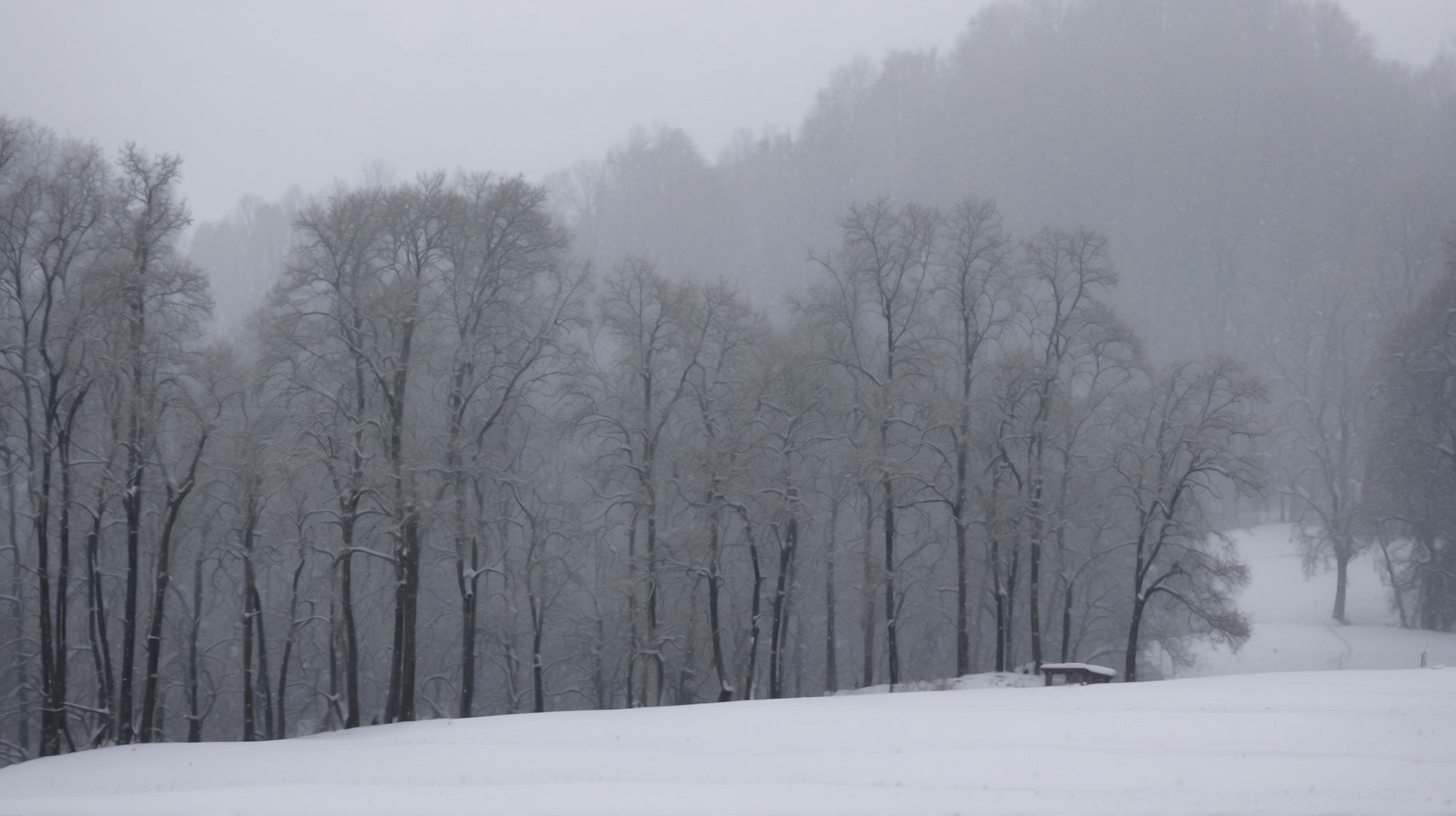
| Expected Snowfall | 12–24 inches in many locations; up to 36 inches in mountain zones |
| Wind Gusts | Up to 60 mph in open areas |
| Temperature Lows | -30°F with wind chills pushing below -40°F |
| States of Emergency | Declared in ND, MN, WI, and parts of NY and PA |
What makes this storm so dangerous
This storm is notably perilous due to a combination of three key meteorological factors: intensity, duration, and breadth. A deep Arctic front is clashing with moist air masses drifting northeastward, creating an optimal environment for rapid snowfall and severe icing. In some regions, snowfall rates are exceeding 2 to 3 inches per hour, overwhelming snow removal operations and leaving travelers stranded for hours.
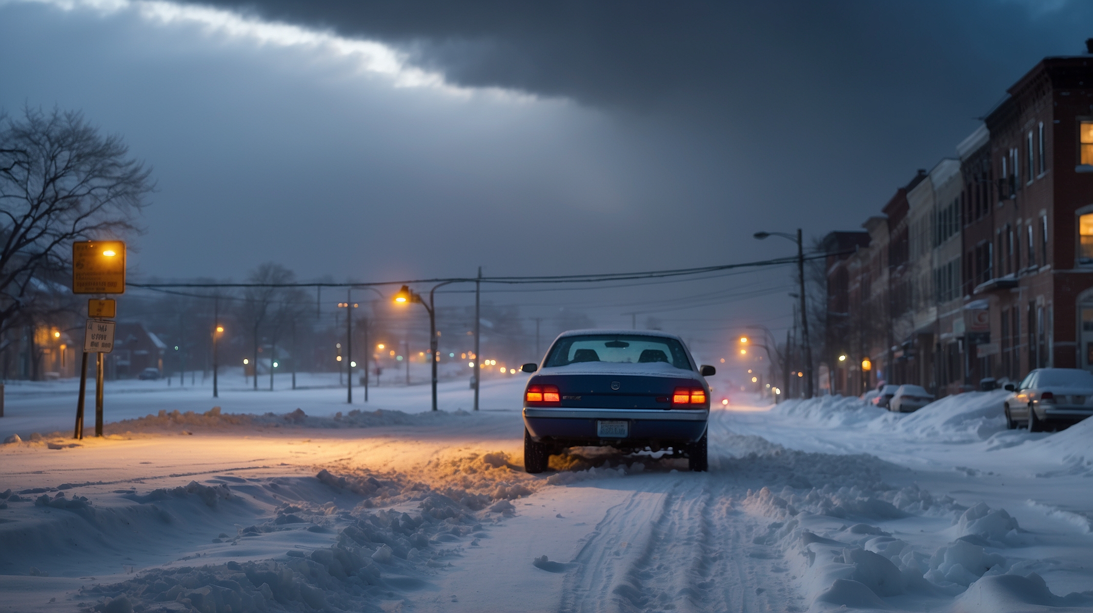
More concerning is the shift between freezing rain and snow caused by atmospheric layering—what meteorologists call a ‘warm nose’—which contributes to dangerously slick roadways. This leads to black ice conditions, primarily during overnight hours, when visibility and reaction times decrease significantly.
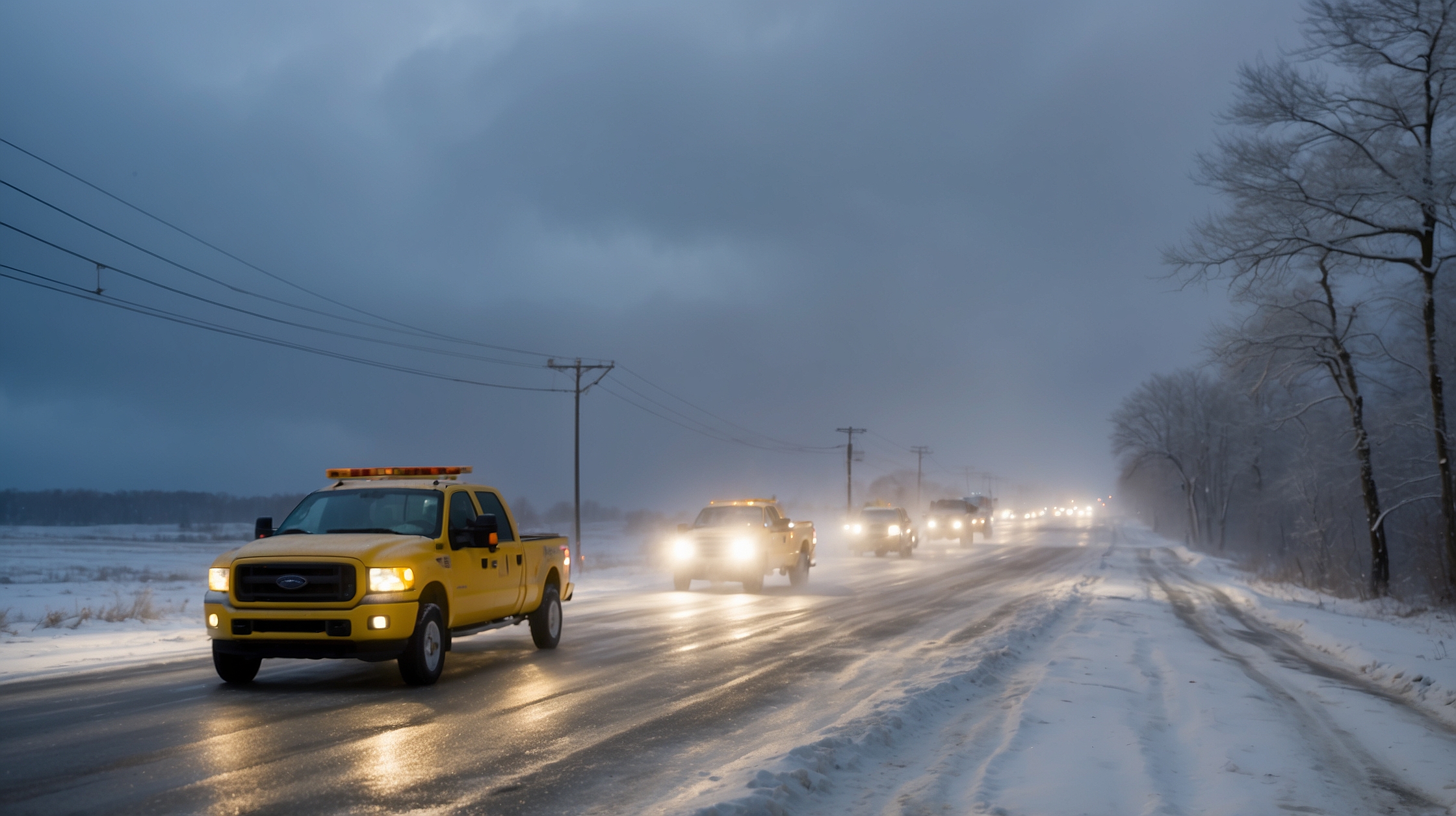
Additionally, widespread wind gusts are creating whiteout conditions and drifting snow, reducing visibility to near zero in rural and open regions. This makes travel virtually impossible, prompting advisories to stay home unless absolutely necessary.
Where the storm is headed next
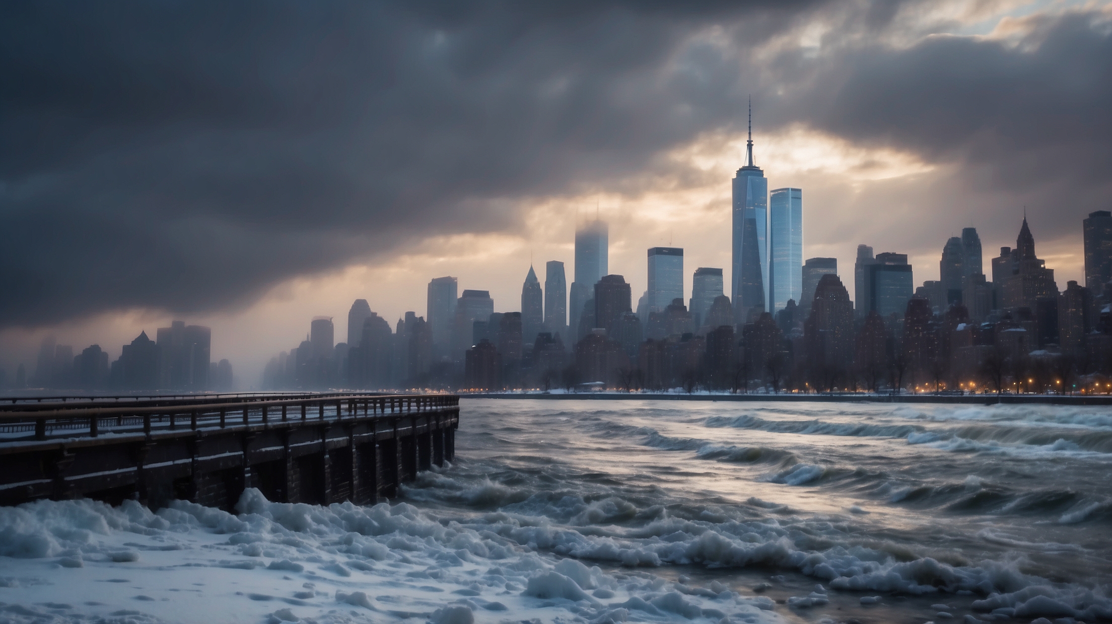
The storm system first made landfall on the West Coast, dumping heavy snow in the Sierra Nevada Mountains, and is now moving rapidly toward the Northeast. Cities like Chicago, Detroit, and Buffalo are already seeing whiteout conditions, and forecasts suggest that Boston and New York City could soon be affected by the tail end of the storm, primarily through sleet and icy rain rather than deep snowfall.
Southern states won’t be spared either. Due to the storm’s broad reach, cold air plunges are expected as far south as Texas and Georgia. Some areas previously unused to winter precipitation will likely face ice-covered roads and sporadic power outages.
Emergency response and power outages
Utility companies from the Midwest to the Northeast are gearing up for extensive outages. With ice placing additional weight on power lines and tree limbs, thousands of households have already lost electricity. Emergency crews advise maintaining a three-day supply of food, water, and essentials including battery-powered radios and extra blankets.
State and local governments have mobilized National Guard units and activated Emergency Operation Centers. Crews are working around the clock to pre-treat roadways with brine and deploy snowplows in hot zones. However, many officials admit this storm’s fast-moving nature makes it nearly impossible to stay ahead of its path.
“This winter storm is not only intense but also uniquely challenging in how quickly it’s evolving. We’re urging residents to remain home and allow emergency crews to handle the situation as safely as possible.”
— Megan Alvarez, FEMA Regional Director
Travel advisories and flight cancellations
Over 2,000 flights have been canceled as major airports from Denver to JFK struggle to navigate runway visibility and deicing issues. Airlines have issued weather waivers allowing passengers to rebook with no fees. Amtrak and local rail services are also facing delays and temporary service suspensions, especially in heavily snow-covered corridors.
On the roads, Interstate closures span across multiple states, including I-80 in Nebraska and parts of I-94 in Minnesota. Officials warn that even if roads appear passable, drifting snow and unseen ice significantly increase the risk of accidents.
Schools and institutions called to close
Thousands of schools and universities have canceled in-person learning and switched to remote instruction. Major districts in Wisconsin, Michigan, and Pennsylvania cited the dual concern of transportation safety and power stability. In New England states, Saturday test sessions for college apps and community activities have also been postponed indefinitely.
Hospitals are on high alert, with many medical facilities activating snowstorm response plans and staff working extended shifts to ensure continuity of care. Shelters are opening across key urban areas, giving the homeless a warm place to stay during the frigid nights.
Supplies, shortages, and preparedness tips
Grocery stores in storm-impacted areas have seen surges in demand, with shelves emptied of essentials like bottled water, bread, and batteries. Hardware stores are reporting increased sales of snow shovels, heating fuels, and ice melt. FEMA is encouraging residents to prepare for possible isolation by stocking pantry basics, having flashlights ready, and charging devices ahead of power outages.
“The best protection during a storm like this is preparation. Know your alerts, stay informed, and listen to local authorities.”
— Dr. Alex Rhoads, National Weather Service Meteorologist
Winners and losers of this powerful winter storm
| Winners | Losers |
|---|---|
| Utility and snow removal contractors | Airlines, logistics companies, travelers |
| Grocery and hardware retailers | Public transport systems |
| Ski resorts in the Rockies | Schools and daycares disrupted by closures |
FAQs about the winter storm
How long is the winter storm expected to last?
Most areas will experience storm conditions for 48 to 72 hours, though lingering effects like refreezing and strong winds may persist longer.
What regions are at highest risk right now?
The Midwest and Great Lakes regions are currently facing the greatest impact, particularly states like Minnesota, Wisconsin, and Michigan.
Can I still travel by air or road?
Travel is highly discouraged unless absolutely necessary. Many flights are canceled and road conditions are deteriorating rapidly.
What should I pack in a winter emergency kit?
Water, non-perishable food, flashlight, extra batteries, first aid kit, warm clothing, phone charger, and a battery-powered radio are essentials.
Are schools and universities closing nationwide?
Closures are regional but widespread across much of the Northern U.S. Many schools have opted for temporary remote learning setups.
What’s the best way to stay informed during the storm?
Use weather radios, local news, and official alerts from the National Weather Service or state emergency notifications.
How can I help vulnerable neighbors in the storm?
Check on elderly neighbors, assist with snow removal if safe, and help ensure they have access to warmth and essentials.
Will the power grid be able to handle the storm?
Grid stress is expected in some regions. Utilities are working to respond quickly, but residents should be prepared for possible outages.